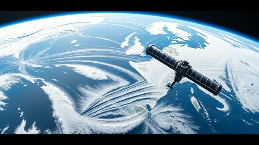
Weather Satellites Updates: Latest Technology and Advancements
The weather monitoring community has entered an era where real‑time data streams from orbiting platforms are no longer a luxury but a necessity. Modern climatologists, emergency managers, and agricultural planners rely on continuous feeds that capture atmospheric dynamics with unprecedented precision, enabling them to predict severe storms, heatwaves, and flooding events hours—or even days—earlier than before. Central to this transformation are the rapid cycles of hardware refreshes, software overhauls, and algorithmic enhancements that keep the global constellation of observation assets at the cutting edge of science.
Thank you for reading this post, don't forget to subscribe!In recent years, however, the pace of change has accelerated dramatically. New sensor suites, higher‑resolution cameras, and advanced microwave instruments have broadened the scope of what can be measured from space, while cloud‑based processing pipelines turn raw measurements into actionable forecasts in seconds. The integration of these innovations is chronicled through ongoing weather satellites updates, which serve as a public ledger of progress for both policymakers and researchers alike.
## Table of Contents
– How Weather Satellites Work
– Recent Technological Advances
– Role of Satellite Imagery in Forecasting
– Data Transmission and Real‑Time Updates
– Challenges and Future Directions
– Comparison of Current Satellite Generations
– FAQ
– Conclusion and Final Takeaways
## How Weather Satellites Work
Weather satellites orbit the Earth in two primary configurations: geostationary (GEO) and polar‑orbiting (LEO). GEO platforms, stationed at roughly 35,800 km above the equator, maintain a constant view of the same hemisphere, providing continuous visual and infrared monitoring of cloud development, storm movement, and solar radiation balance. In contrast, LEO satellites circle the planet every 90‑120 minutes, delivering high‑frequency swaths of data across all latitudes. This dual‑system architecture ensures both temporal continuity and spatial completeness.
The core of each satellite is a suite of sensors that detect electromagnetic radiation across a broad spectrum. Visible‑light cameras capture cloud patterns recognizable to the naked eye, while infrared detectors sense temperature differentials invisible to humans, allowing forecasters to infer moisture content and convective intensity. Microwave radiometers penetrate clouds to retrieve atmospheric humidity profiles, a critical input for numerical weather prediction models. All of these measurements are calibrated on‑board and continually validated against ground‑based reference stations.
## Recent Technological Advances
The last decade has witnessed a quantum leap in sensor resolution and radiometric accuracy. Modern geostationary platforms now host Advanced Baseline Imagers (ABI) capable of capturing 16 spectral bands at a spatial resolution of 0.5 km for visible light—four times finer than the legacy instruments they replace. Meanwhile, the JPSS series of polar satellites introduced the Visible Infrared Imaging Radiometer Suite (VIIRS), which merges high‑resolution reflective‑solar bands with medium‑resolution infrared channels, delivering a richer dataset for both short‑range warnings and climate monitoring.
Beyond hardware, software breakthroughs have reshaped the data pipeline. On‑board artificial intelligence algorithms now pre‑process raw frames, flagging noisy pixels and correcting for spacecraft motion in real time. This reduces the latency between acquisition and product generation from several minutes to under a minute for critical products such as Severe Storm Alerts. Additionally, the adoption of cloud‑native processing platforms has democratized access, allowing researchers worldwide to spin up virtual machines that ingest satellite streams directly from the space agency’s public API.
For users tracking the evolution of these capabilities, each weather satellites updates is documented in technical bulletins that outline new spectral bands, calibration methods, and data latency improvements. These bulletins are essential for updating downstream models and maintaining consistency across international forecasting consortia.
## Role of Satellite Imagery in Forecasting
High‑resolution Satellite Imagery has become a linchpin for modern numerical weather prediction (NWP). By feeding detailed surface and atmospheric state vectors into data assimilation systems, forecasters can nudge model initial conditions closer to reality, thereby narrowing forecast error margins. This is especially true for fast‑moving convective systems where every kilometer of spatial detail can influence the predicted track and intensity of a thunderstorm.
Operational centers now ingest not only static snapshots but also rapid‑scan mosaics that stitch together consecutive frames into a three‑dimensional view of cloud tops and moisture plumes. Such products enable “nowcasting” techniques that blend radar echoes with the latest satellite observations to produce hyper‑local forecasts for the next 0‑6 hours. The integration of multi‑sensor data—visible, infrared, and microwave—creates a synergistic picture where each band compensates for the limitations of the others, producing a more robust representation of atmospheric processes.
Industry analysts often reference how the continual stream of weather satellites updates reduces the “data gap” during night hours over oceanic regions, where conventional observations are scarce. This improvement directly translates into more accurate hurricane intensity forecasts, saving lives and property by enabling earlier evacuation orders.
## Data Transmission and Real‑Time Updates
Sending terabytes of data from orbit to ground stations is a logistical feat that has evolved alongside satellite capabilities. Historically, satellites relied on narrowband X‑band downlinks, which limited the volume and rate of data that could be transmitted. Modern platforms employ high‑throughput Ka‑band transmitters coupled with agile beam‑forming antennas, enabling gigabit‑per‑second streams to a global network of ground stations.
Once received, data passes through a series of ground‑segment processing clusters. The first stage involves Level‑0 de‑commutation, converting raw bitstreams into calibrated radiances. Subsequent stages (Level‑1 and Level‑2) apply geometric corrections, atmospheric corrections, and generate geolocated products. The final products—such as Cloud‑Top Temperature maps or Aerosol Optical Depth—are then broadcast via public APIs, ftp sites, and even directly into commercial weather apps through webhooks.
One innovation worth noting is the implementation of “data‑on‑demand” services, where users can request specific swaths or temporal windows via a RESTful interface, receiving tailored datasets within seconds. This approach reduces unnecessary bandwidth consumption and allows mission operators to prioritize critical data during high‑impact weather events.
## Challenges and Future Directions
Despite the remarkable progress, several hurdles remain. Sensor degradation due to harsh space environments continues to affect long‑term radiometric stability, necessitating frequent recalibrations. Moreover, the growing number of micro‑satellite constellations introduces spectrum congestion, compelling agencies to negotiate shared frequency allocations to avoid interference.
Looking ahead, the next generation of weather satellites promises hyperspectral capabilities that capture hundreds of narrow spectral bands, vastly expanding the range of atmospheric constituents that can be observed. Coupled with on‑board quantum‑enhanced processors, these future platforms could execute complex data assimilation cycles in orbit, delivering “edge‑computing” forecasts directly to end‑users without intermediary ground processing.
The roadmap for ongoing weather satellites updates includes ambitious plans for a lunar‑orbiting atmospheric monitor, which would provide a unique perspective on Earth’s albedo and the impacts of solar variability. Collaborative international programs are also exploring shared launch services and joint data‑sharing agreements to reduce costs and enhance global coverage.
## Comparison of Current Satellite Generations
| Generation | Primary Orbit | Key Sensors | Spatial Resolution (Visible) | Data Latency |
|---|---|---|---|---|
| Legacy GEO (e.g., GOES‑13) | Geostationary | Imager, Sounder | 1 km | 5 min |
| Current GEO (e.g., GOES‑16/17) | Geostationary | ABI (16 bands) | 0.5 km | 1 min |
| Legacy Polar (e.g., NOAA‑15) | LEO (Polar) | AVHRR | 1.1 km | 30 min |
| Current Polar (e.g., JPSS‑1) | LEO (Polar) | VIIRS, CrIS | 0.5 km (VIS) | 5 min |
| Next‑Gen (Planned 2028) | Mixed GEO/LEO | Hyperspectral, AI‑Enabled | 0.25 km | ≤30 s |
## FAQ
**What is the primary benefit of newer geostationary imagers?**
Higher spatial resolution and faster scan rates improve storm tracking.
**How often are satellite data refreshed for operational use?**
Typically every 5–15 minutes, depending on the sensor and orbit.
**Can the public access real‑time satellite products?**
Yes, most agencies provide open APIs and web portals.
**What role does AI play in satellite data processing?**
AI automates noise reduction, cloud classification, and rapid product generation.
**Why are hyperspectral sensors considered a game‑changer?**
They capture detailed spectral signatures, enabling precise constituent retrieval.
## Conclusion and Final Takeaways
The rapid cadence of weather satellites updates reflects a broader shift toward data‑centric, collaborative meteorology. By marrying cutting‑edge sensor technology with high‑throughput communications and AI‑driven processing, today’s satellite fleet delivers a level of situational awareness that was unimaginable just a few decades ago. For professionals who depend on accurate forecasts—whether in emergency management, aviation, agriculture, or renewable energy—staying attuned to these updates is essential for maintaining operational readiness.
At the same time, the challenges of sensor longevity, spectrum management, and equitable data access remind us that the journey is far from complete. Continued investment in next‑generation platforms, international partnerships, and open‑source processing frameworks will ensure that the benefits of space‑based weather observation remain inclusive and resilient. By integrating each new capability thoughtfully, the scientific community can transform raw observations into decisive actions that protect lives, safeguard economies, and deepen our understanding of Earth’s dynamic atmosphere.
For further reading on the evolution of satellite technology, you may explore detailed mission briefings or consult the latest research papers. Additionally, a quick web search can provide up‑to‑date news articles: search results.